Peak 15 | Dinara, Croatia | 1831m | 31st May 2019
- Adam Stevenson

- May 31, 2019
- 4 min read
Updated: Nov 12, 2019
Croatia was the first in the series of Balkan high points in the project. The region is bursting full of history, great weather and not least - amazing mountains.

Quick Summary
• Starting point - Glavas
• Route taken - Via Planinarska
• Total ascent - 1300 m
• Total length - 16.4 km round trip
• Total time for climb -7¾ hours
• Expense category - #Low
• Equipment - #StandardHike
• Difficulty - #Level3 of 5
• Enjoyment - #3stars of 5*
Beating the storm
30th May
I had to make a last minute change of plan for this one in order to avoid some incoming bad weather. The mistake I made was not checking the advanced weather forecast before heading to Croatia. I guess I was just expecting clear skies and sun around this area. So when I finally checked it came as a bit of a shock.
It had been the wettest May in the area for 30 years! Heavy rain and lightning symbols littered my weather report. There was just one clear day before the thunderstorms rolled in.
- they were forecast for the following 4 days after as well.
So I made the decision about 11 pm just as I was heading to bed, to skip our planned day at Plitvice Lakes and make an attempt on the mountain instead. The mountains needed to come first in the trip. But it meant that I would need to get up early as it was a 2 hour drive away from where we were staying to get to Dinara. I would also need to return the same day so we could re-group before moving on.
Climbing to the highest point of Croatia
31st May
I woke up before my early alarm, (something that I tend to do when I'm excited for a big hike) and got on my way. It was a great little morning drive in fairness, I had beautiful Croatian scenery either side of me nearly all the way, and after a few days of overcast weather, it was great to finally see some blue skies re-appearing again.

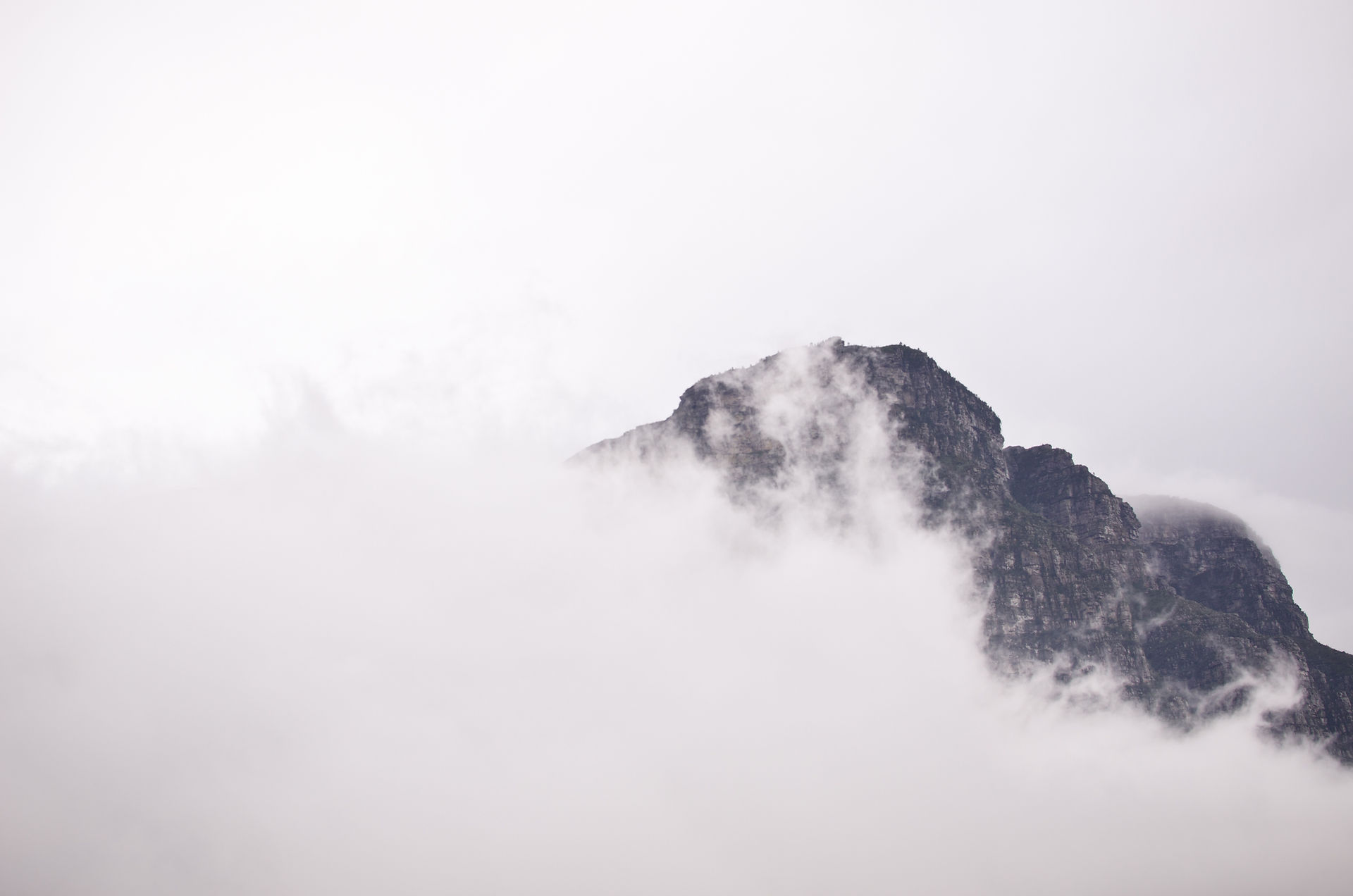
As soon as Dinara came into view it made such a dominant feature on the landscape. Its not just the height that makes this impressive but the length. Its a 20 km+ long massif mountain range where the highest point on the Croatian side is known as Sinjal, at 1831m above sea level.

There are at least three different routes up to the summit, but I started and parked at the Glavas Hut (550m) just outside the small hamlet of Glavas. From here its approximately 10km walk to the top.

Not long after leaving the car, a partly destroyed castle came into view. As I got closer I passed an information sign next to it. It was called the Dinaric Fortress built in the 15th century. It looked pretty cool but I was keen just to get on with the hike at this point so I walked straight past it and continued on my way up - but I did explore it on my way back down.

The trail was pretty easy to follow. There were red and white markers very frequently along with several signs posts with destinations and estimated walking times. I thought it would be hard for someone to get lost on this one.

The hike never got particularly hard either. It was quite an enjoyable walk and the terrain had a fairly consistent gradient on the way up.

Two hours into the hike I would pass the first people of the day at around 1300m. They were a couple that were stopped having their lunch at an abandon farmers building. I asked if they were heading to Dinara. They told me that they had not long decided to turn back after an attempt to it. Having got up to around 1600m they said it had got too cloudy and windy for them to carry on. I thanked them and continued on my way up as I felt like I was well prepared to handle the colder windier weather.

Going up from this point there were a few false summits until reaching a summit stone. This was not the summit that I was looking for but infarct a..

The main ridge-line that I could see from the road in the morning is approximately 1600 m. The last 200 meters in altitude was hidden from view at ground level because its set a little further back from the face of the mountain. From this point I would be heading into the clouds. However, if anything the clouds were helping me by shielding the hot weather that was more normal for this time of year.

Walking through the last part, the scenery seamed to suddenly changed. I found myself going through a low lying forest of dead tress. I couldn't work out why they were all dead. With the reduced viability by this point, it felt like that dark scene from the Lion King.

When I reached the summit I accidentally gave a German couple that were sat having some food a bit of a shock. I been the first person they had seen all day and they obvious weren't expecting to bump into someone at 1800 m.

I felt good to do this one done before the bad weather came in. It actually worked out really well switching the days around.

Tags


Comments